Find us at PORCH: An Architecture of Generosity, the 2025 United States Pavilion at the 19th International Architecture Exhibition. Visit the Biennale page for more.
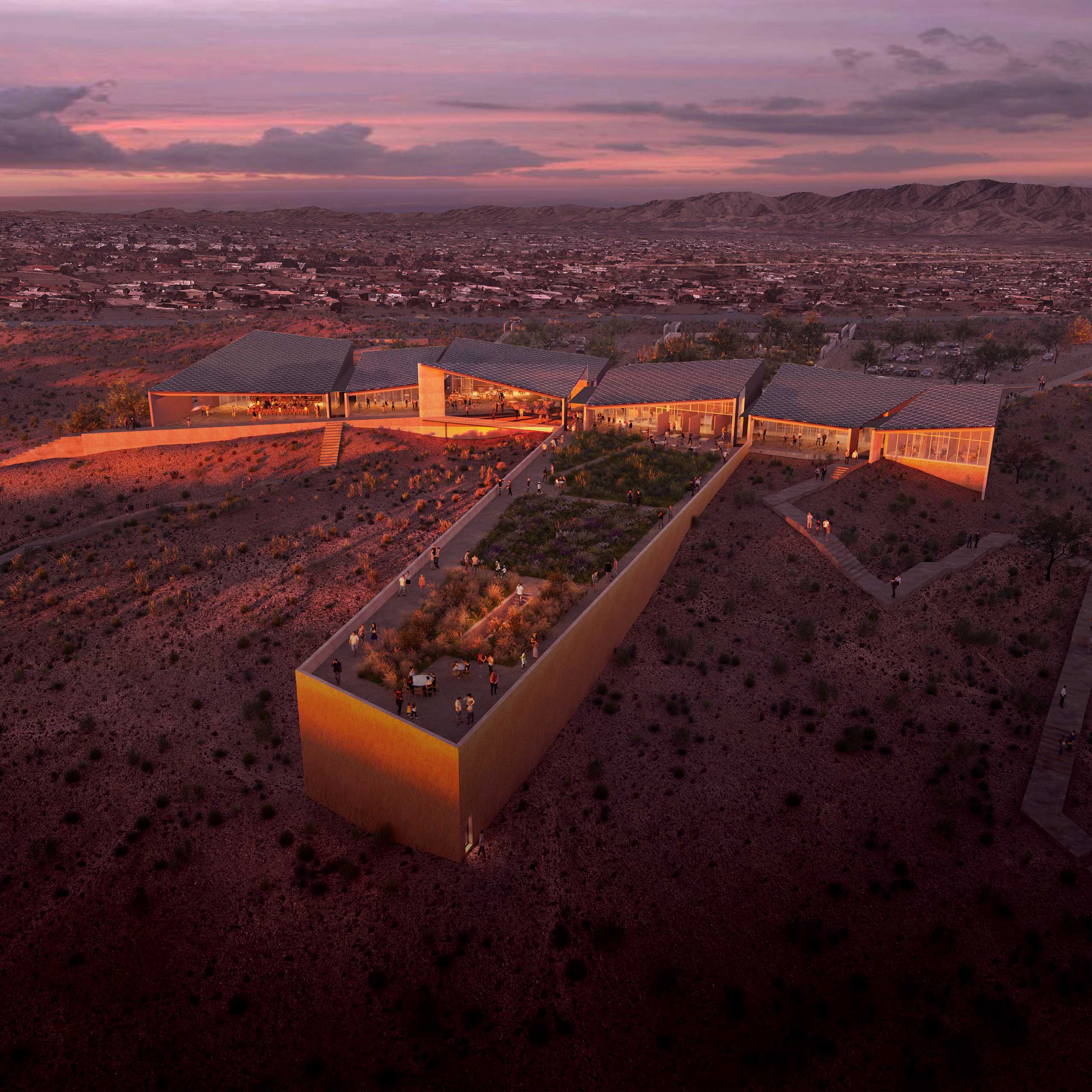
Our winning submission for the 2019 AIA Phoenix Metro Design Competition is a masterplan concept reimagining the forgotten space surrounding an urban river as a new symbol of unification. With a prompt to develop a resilient community gathering space along the Rio Salado, Rio Unido creates a link between two long-separated communities to engage in a more sustainable relationship with our water. Where it once divided, this intervention instead re-envisions the waterway as a critical convergence: a place for discussion, discovery, celebration, and reflection.
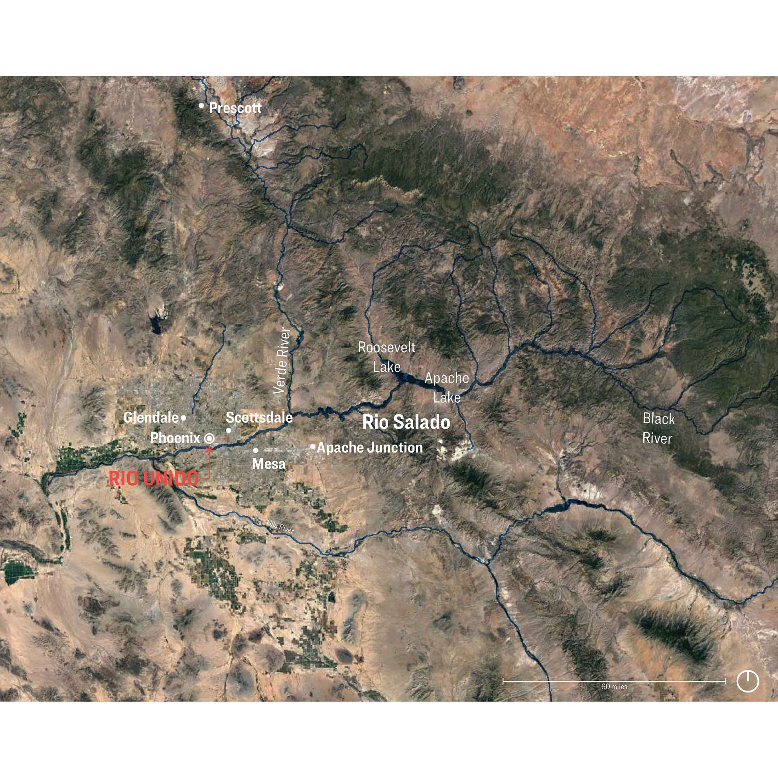
Regional Context
Context and Relationships
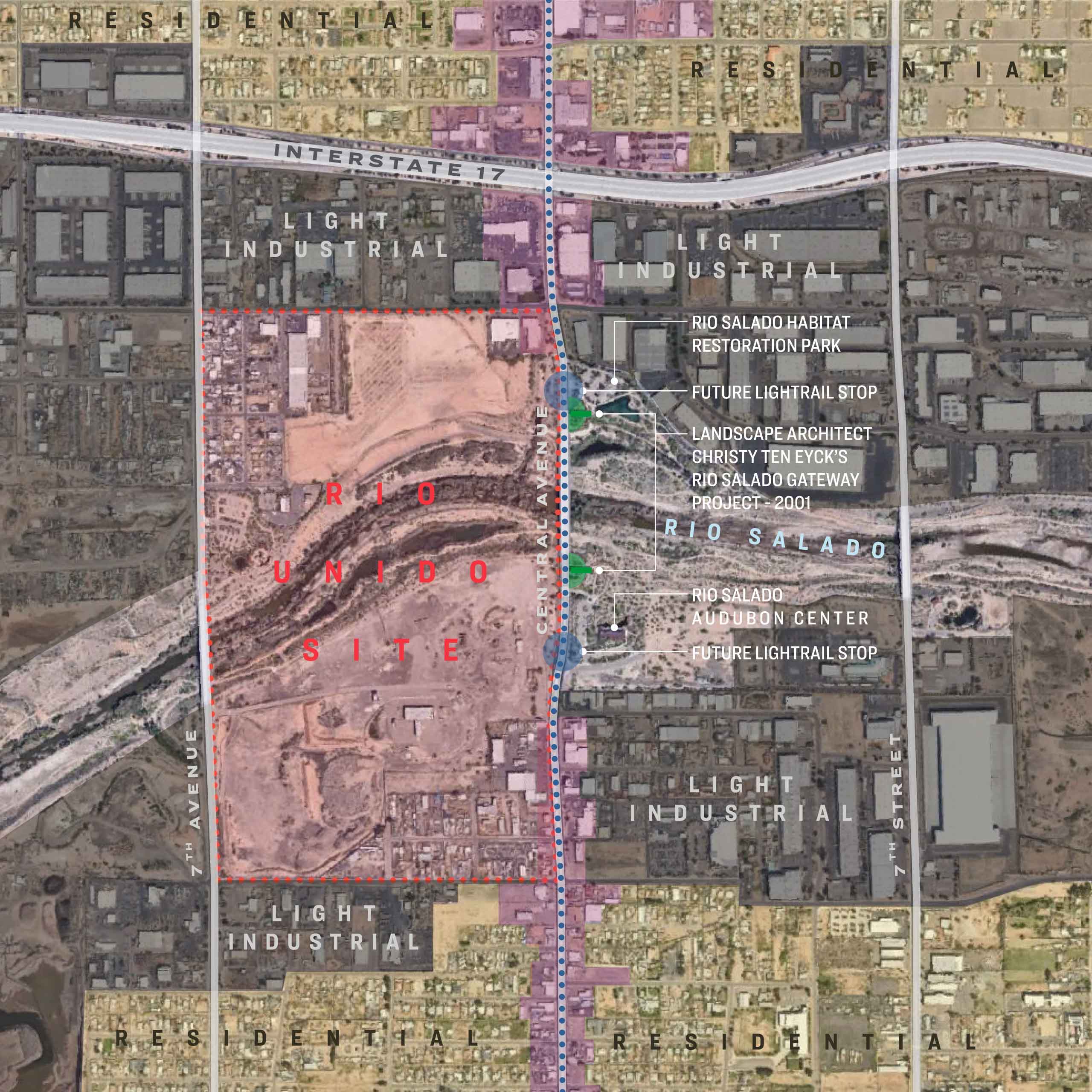
Urban Context
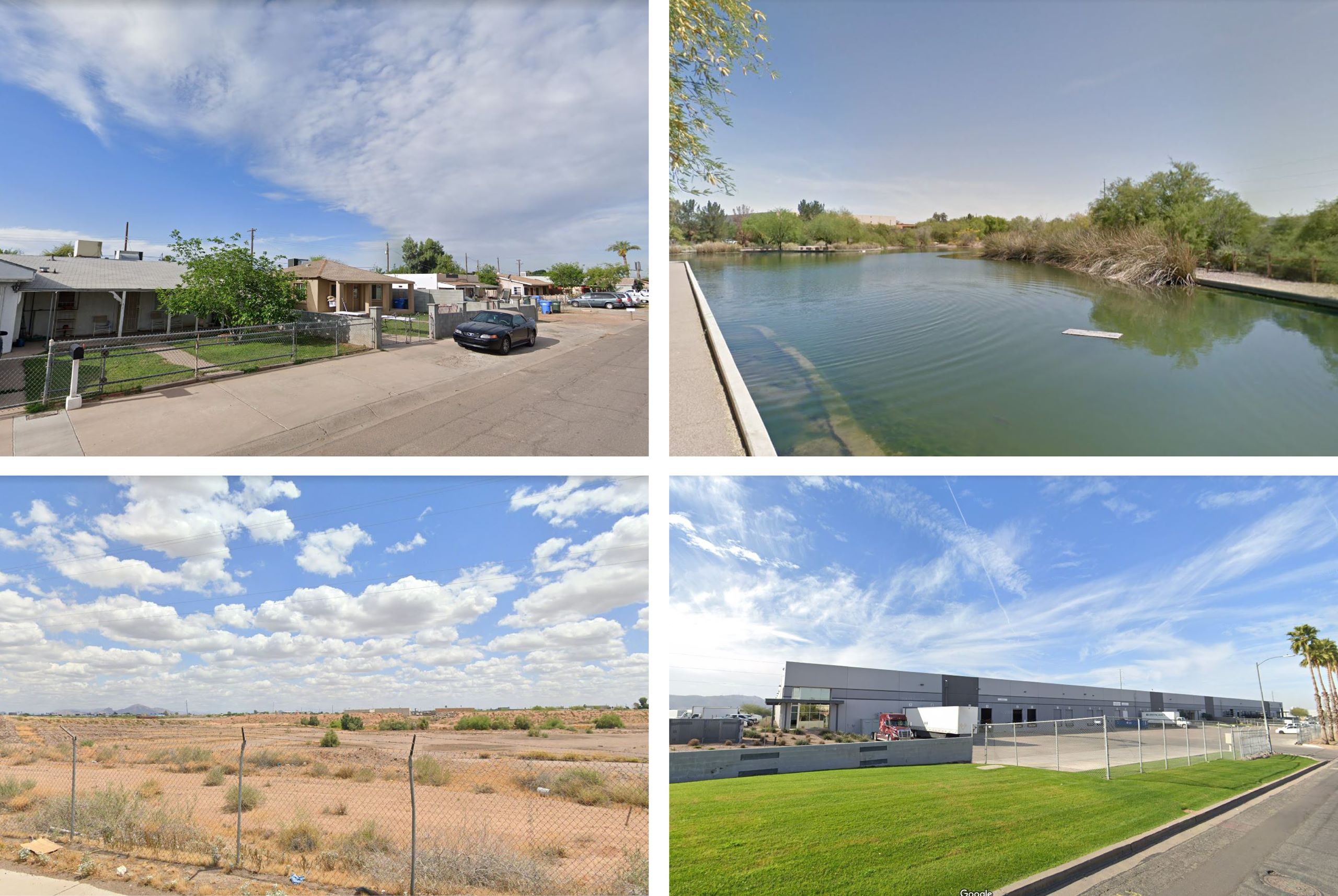
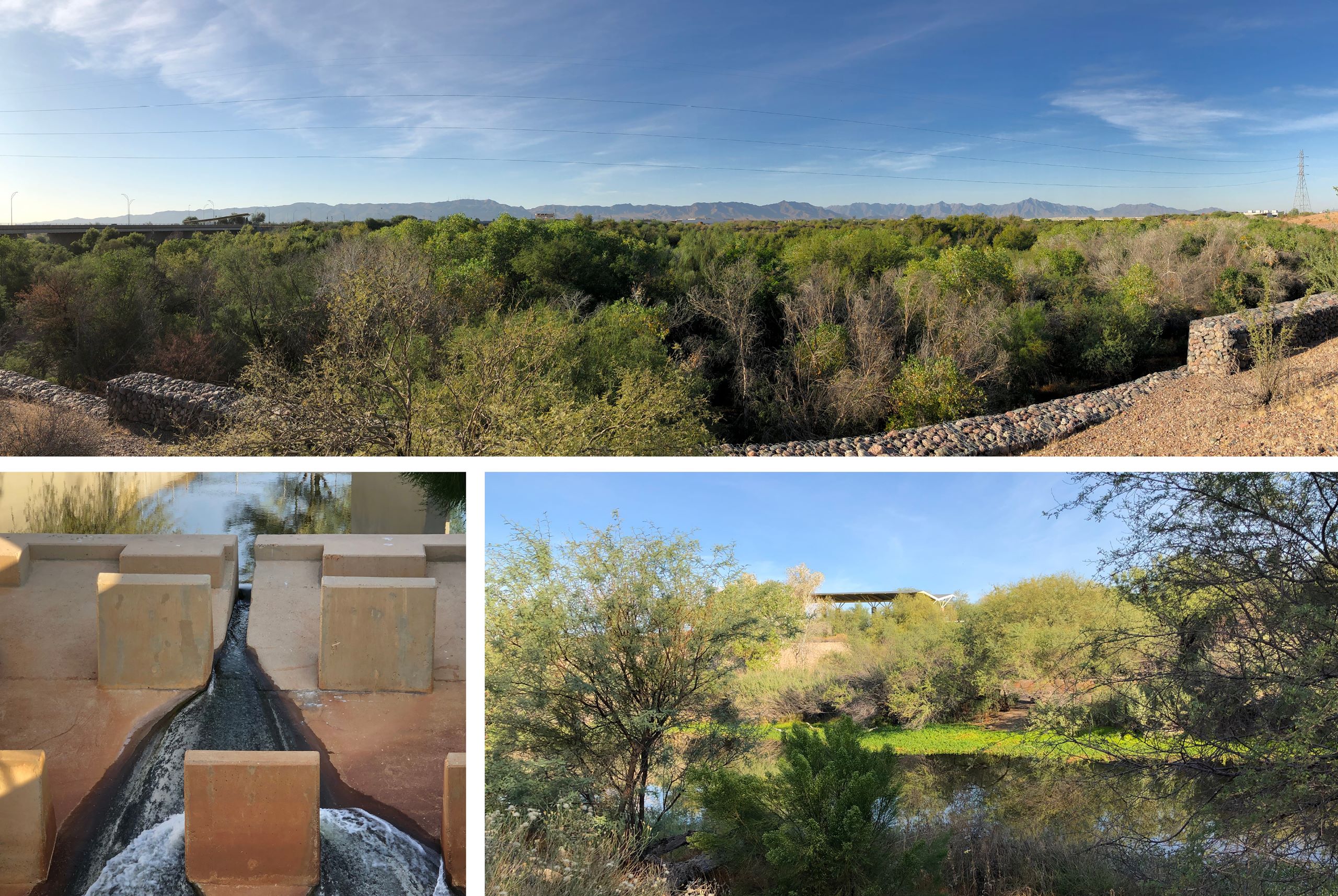
Existing Conditions
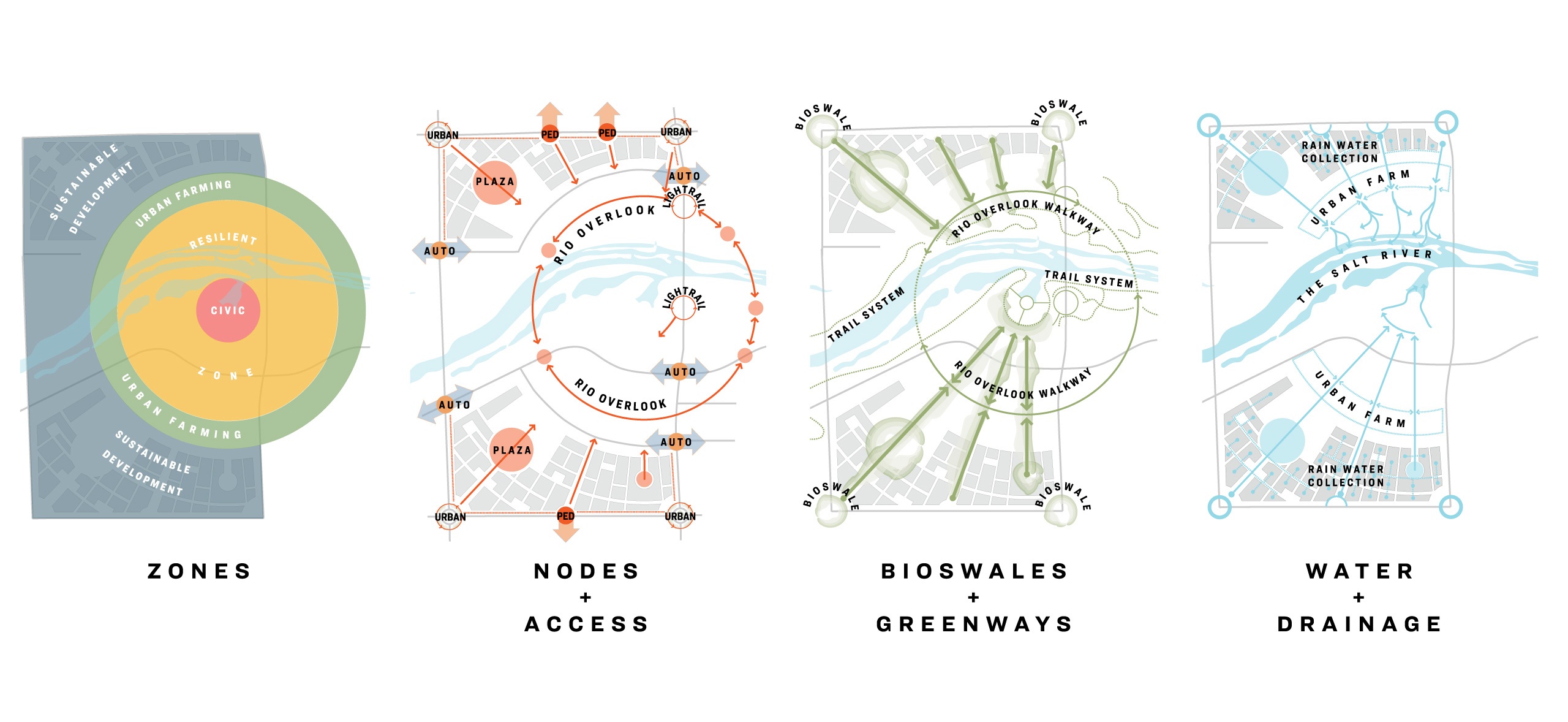
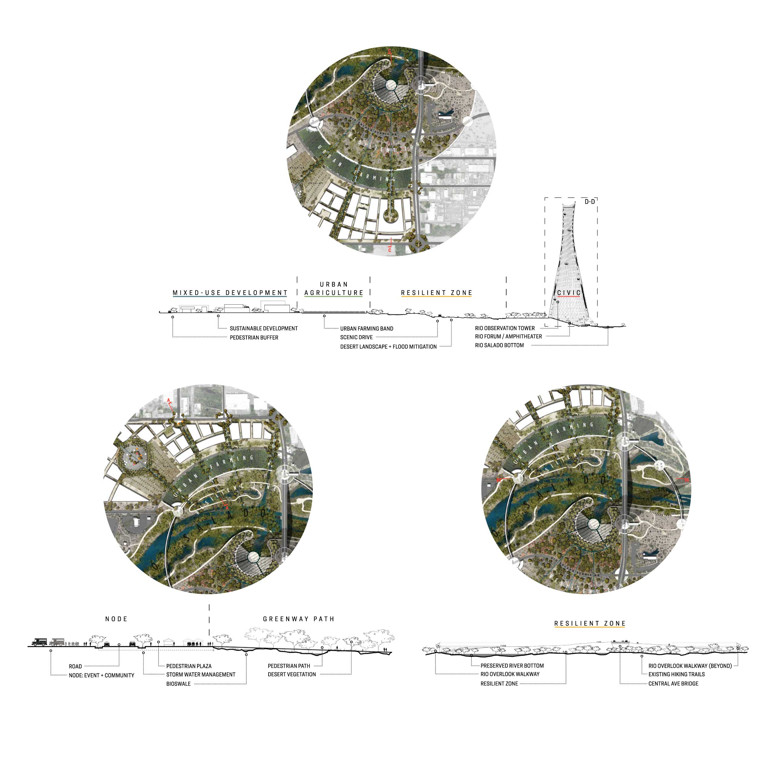
The site along Central Avenue, adjacent to several riparian habitat restorations, was chosen for its potential to reconnect Downtown and South Phoenix at a place steeped in a history of segregation and environmental racism, acting as a bridge weaving together each side. Historically, the banks along the waterway—with an abundance of industrial warehouses, brownfield sites, and active gravel mines—kept the Rio from connecting to the greater urban fabric. The new district acts as an intermediary between the surrounding communities and the Rio Salado, linked through a series of nodes, pathways, and ringed zones beginning at the urban edge and leading to the central civic zone at the water’s edge.
Site Organization
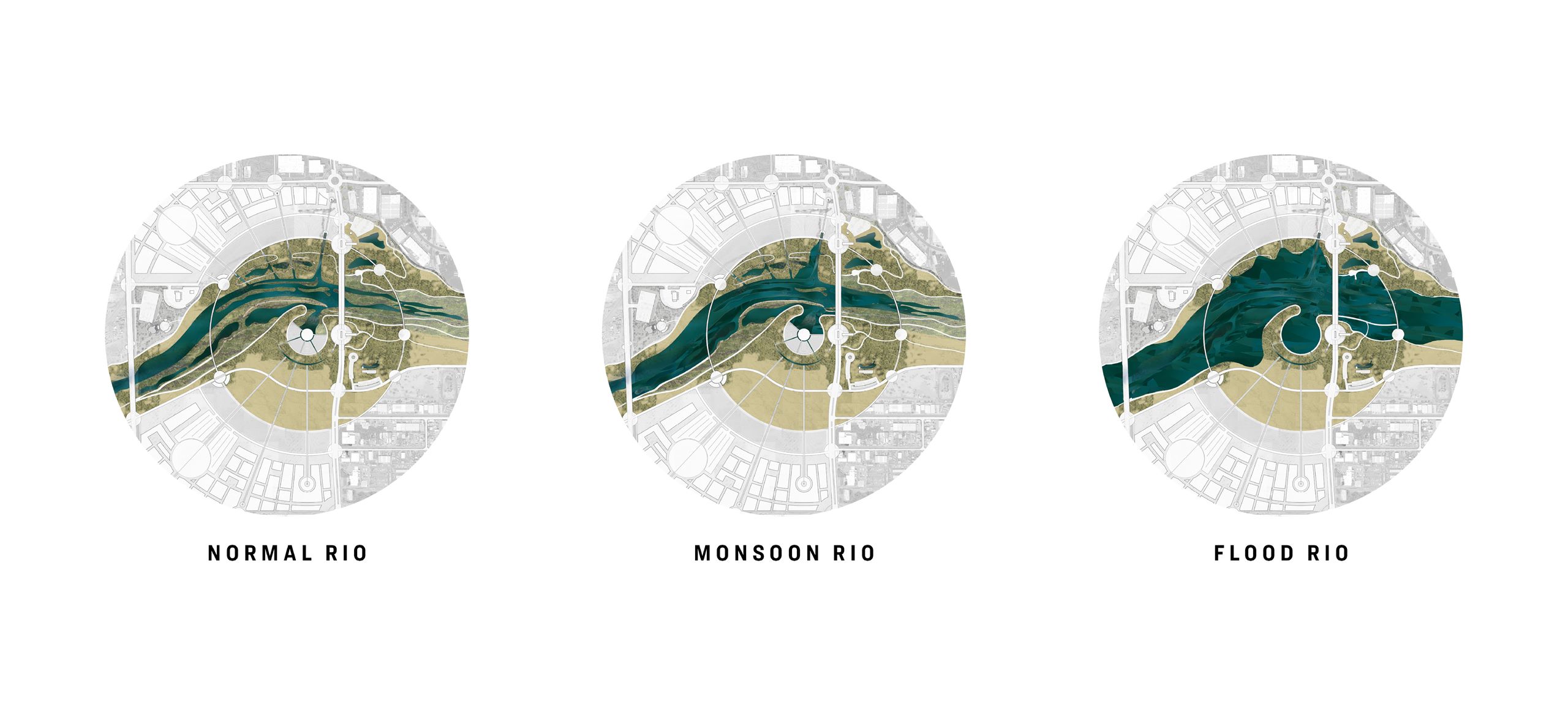
Touching the periphery of the site, the outer ring is comprised of mixed use development activating the site edges and integrating with its surroundings. This zone draws the adjacent neighborhoods to this natural amenity while creating a sustainable, balanced economic model for future development. The next ring in is a zone of urban agriculture, honoring the Valley’s rich history of food production while demonstrating how hyperlocal agriculture can flourish. This zone forms a buffer between the outermost ring interfacing with the neighboring residential, commercial, and light industrial areas of the city and the solace at the center of the site. At once recreational, conservational, and educational, the Resilient Zone is where the waterway and desert flora exist as a natural environment. This zone provides resilient infrastructure to the district, embracing extremes of drought and flood and displaying the natural cycles.
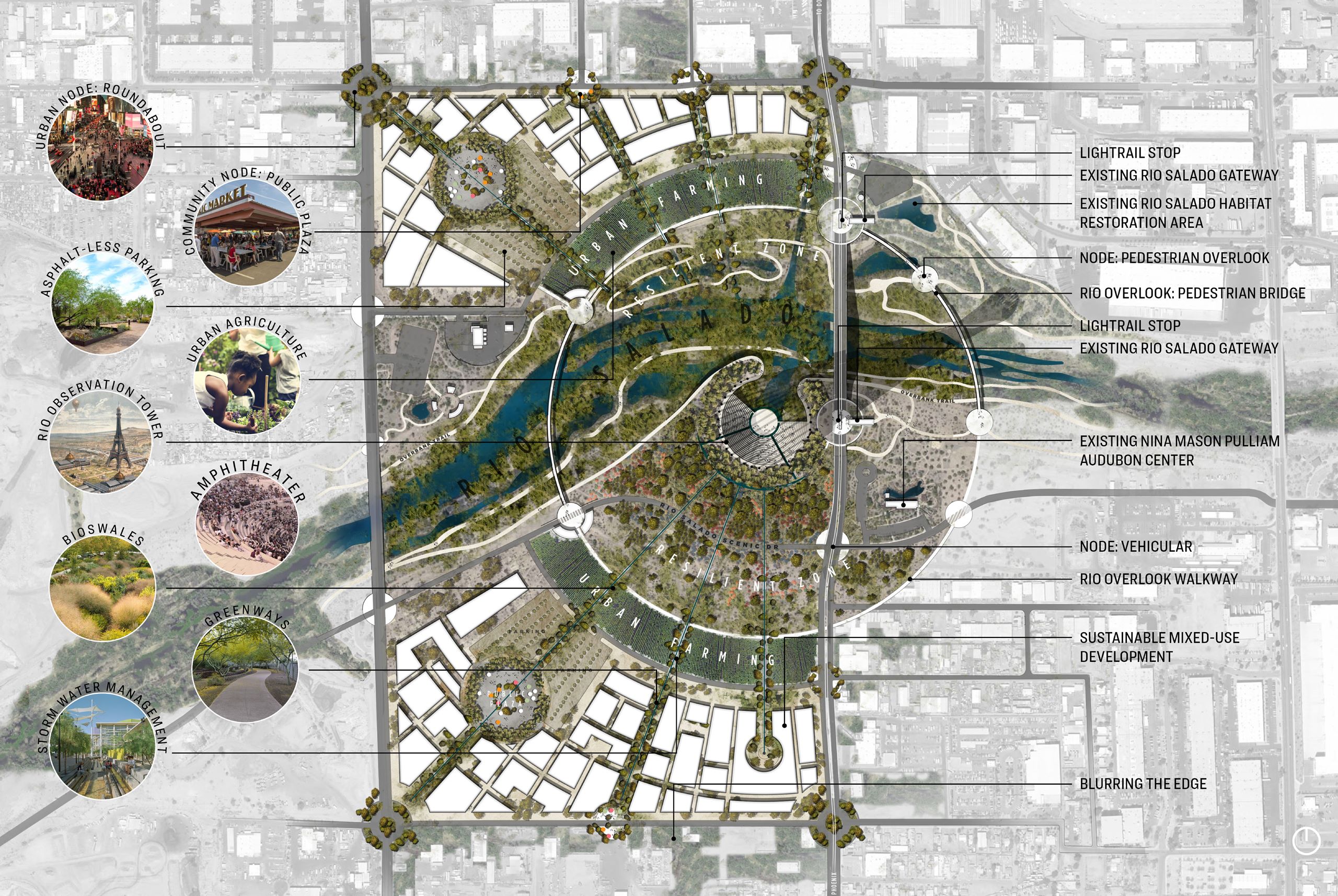
Site Plan
A network of greenways radiate to connect nodes along the edge of the site, providing direct, shaded paths to the waterway, integrating bioswales to naturally filter water on site and releasing it for direct replenishment of the aquifer. Each zone is delineated by rings of pedestrian and vehicular circulation intersecting these greenways, accentuated by a scenic Rio Overlook drive and a 1.5-mile circular walking path bordering the Resilient Zone, bridging across the Rio, and presenting a visceral experience of the riparian habitat. All paths lead toward the symbolic center of this intervention: a monument to the water.
Resilient Zone
Site Sections
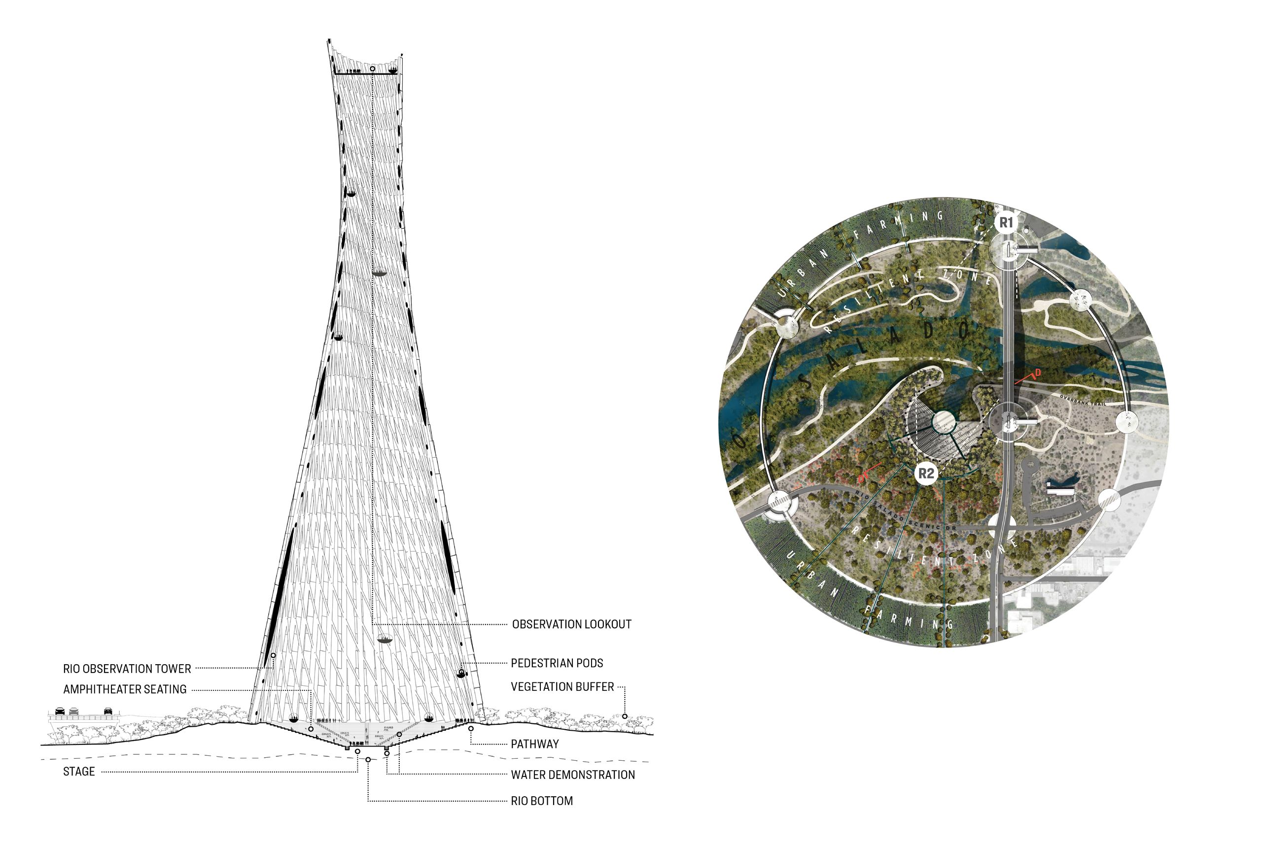
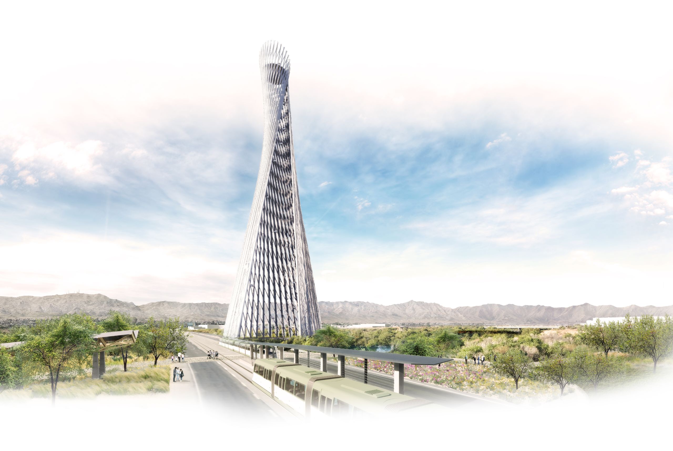
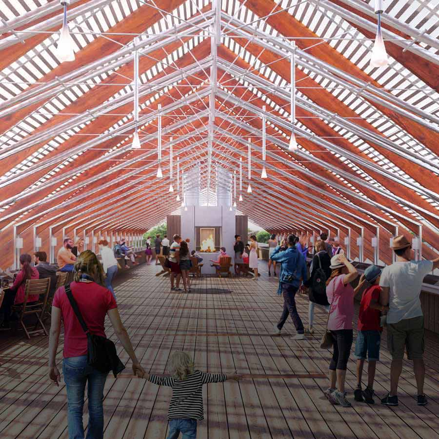
At the center of the district is the Forum—a space for civic engagement against the backdrop of the Rio Salado. This amphitheater, sited at the base of the waterway, utilizes wild vegetation and the water’s presence as a natural heat sink and source of evaporative cooling for the public gathering space. Above the Forum rises the Observation Tower, a beacon to the river and symbol of the Rio’s pivotal importance to life in the Phoenix basin. Inspired by the skeleton of a saguaro, the Tower form stands as a stark figure on the landscape to evoke the fragile nature of water and our vast desert home.